Software engineers have just completed 18 months of analysis of all the data collected for ECOTRAVID’s Virtual Measurement Campaign (VMC) since its launch in January 2020.
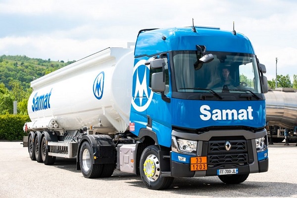
The data, which covers approximately 100,000 kms (62,000 miles) per vehicle of ‘real-life’ journeys on public roads, has been gathered from the 40 trucks and trailers involved in the campaign and operated by transportation and logistics expert Samat. Transmitted back to the fleet management platform of project coordinator CLS at very high frequency, it is being used to fine-tune and adapt the VMC software.
Full range of variables
The responsibility of mathematical research institute Fraunhofer ITWM – developers of the VMC software – analysis of all this data relies on clustering of the routes measured, which cover everything from inner-city to minor country roads to motorways. Each route is subdivided into single trips and then different road-type segments, with specific elements such as fuel consumption computed for each segment individually. And each segment is travelled multiple times in different traffic situations and with different drivers in order to provide a full range of variables in terms of mass and speed for each fixed slope profile.

Detailed insights
The end result of this data analysis phase will be to provide detailed insights into vehicle performance and estimated energy consumption for any virtual drive, enabling ITWM to perfect the parameters and algorithms used in its VMC software. Once the software has been finalized, the campaign will move on to its Demonstrator Development phase.
About ECOTRAVID
ECOTRAVID is an EU-backed project to provide a tool that will significantly reduce emissions from Europe’s vital road haulage industry. It is co-financed by LIFE, the financial instrument of the European Union.
The aim of its Virtual Measurement Campaign (VMC) is to develop road haulage software capable of calculating the greenest route for any specific journey in terms of fuel consumption and emissions, by using information on a range of variables such as topography, traffic and driver behaviour. This ECOTRAVID project consortium is an international collaboration composed by 3 members, Fraunhofer Institute for Industrial Mathematics (ITWM, based in Germany), Collecte Localisation Satellites (CLS, based in France) and Samat Aquitaine (based in France).